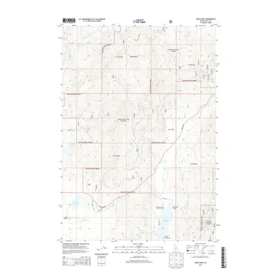
2013 Map of Eagle Nest
USGS Topo · Published 2013About this map
Horsethief Reservoir and its namesake Horsethief Basin dominate the southeastern reach of this high-elevation landscape within the Boise National Forest. The map documents a rugged drainage network where Big Creek and Deep Creek carve through the timbered terrain toward the southern edge of Scott Valley. This area, situated at the junction of several forest road systems including Warm Lake Rd and Eagle Nest Rd, reflects the mid-century development of water management and recreational access in Valley County. Near the western boundary, the terrain transitions into the edge of Long Valley, marked by smaller irrigation features like Calendar Reservoir and Davis Reservoir. The survey provides an intricate look at the local topography surrounding the Eagle Nest lookout area, capturing the Forest Service infrastructure and watershed patterns before modern climate shifts and land-use changes altered the backcountry.
Find a feature on this map
45 named features on this map. Tap any name to fly to it.
Don’t see what you’re looking for? This feature index may not catch every label — zoom into the map to look around manually.
Map Details
Editions of this 2013 Eagle Nest Map
This is the sole edition of this map. No revisions or reprints were ever made.
Other maps of this area

1894 · Squaw Creek
USGS Topo · 1:125,000

1909 · Garden Valley
USGS Topo · 1:125,000

1911 · Meadows
USGS Topo · 1:125,000

1953 · Smiths Ferry
USGS Topo · 1:62,500

1953 · Boiling Springs
USGS Topo · 1:62,500

1954 · Gold Fork
USGS Topo · 1:62,500

1954 · Cascade
USGS Topo · 1:62,500

1955 · Baker
USGS Topo · 1:250,000

1957 · Challis
USGS Topo · 1:250,000

1959 · Baker
USGS Topo · 1:250,000