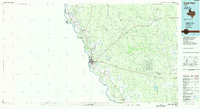
1985 Map of Eagle Pass
USGS Topo · Published 1985About this map
The Rio Grande marks a sharp international boundary between Texas and Mexico, defining the western edge of this Maverick County survey. The landscape is characterized by a network of ephemeral drainages like Elm Creek and Chaparrosa Creek that feed into the river basin. Settlement is concentrated along the river corridor and the Southern Pacific rail line, with Eagle Pass serving as the primary hub of activity and commerce. To the north and south, smaller agricultural and residential clusters such as Quemado, Normandy, and El Indio appear alongside irrigation works and ranch lands.
Find a feature on this map
45 named features on this map. Tap any name to fly to it.
Don’t see what you’re looking for? This feature index may not catch every label — zoom into the map to look around manually.
Map Details
Editions of this 1985 Eagle Pass Map
This is the sole edition of this map. No revisions or reprints were ever made.
Other maps of this area

1896 · Brackett
USGS Topo · 1:125,000

1897 · Brackett
USGS Topo · 1:125,000

1898 · Uvalde
USGS Topo · 1:125,000

1899 · Uvalde
USGS Topo · 1:125,000

1929 · Cotulla
USGS Topo · 1:125,000

1939 · Carrizo Springs
USGS Topo · 1:62,500

1939 · La Pryor
USGS Topo · 1:62,500

1940 · Asherton
USGS Topo · 1:62,500

1940 · Cometa
USGS Topo · 1:62,500

1940 · Eagle Pass
USGS Topo · 1:62,500