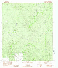
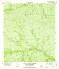
1982 Map of Eagle Pass NE
USGS Topo · Published 1982About this map
Farias Ranch serves as the primary landmark in this rural stretch of South Texas, recorded during a 1976 field check. The landscape is defined by an intricate network of intermittent drainage systems, including the southward-flowing Chueco Creek, Chimeneas Creek, and Saus Creek. These seasonal waterways converge toward the Maverick County Canal and Mule Creek in the southern portion of the quadrangle. The map reveals the infrastructure of large-scale ranching and water management in Maverick County during the early 1980s, highlighting the dependence on engineered waterways like the canal to support the arid brushland. This provisional survey captures the distribution of stock tanks and windmills that supported the local cattle industry before later development altered the traditional ranching boundaries.
Find a feature on this map
7 named features on this map. Tap any name to fly to it.
Don’t see what you’re looking for? This feature index may not catch every label — zoom into the map to look around manually.
Map Details
Editions of this 1982 Eagle Pass NE Map
This is the sole edition of this map. No revisions or reprints were ever made.
Other maps of this area

1940 · Cometa
USGS Topo · 1:62,500

1940 · Eagle Pass
USGS Topo · 1:62,500

1940 · Paloma
USGS Topo · 1:62,500

1940 · Chacon Creek
USGS Topo · 1:62,500

1958 · Eagle Pass
USGS Topo · 1:250,000

1965 · Eagle Pass
USGS Topo · 1:250,000
1974 · Indian Tank
USGS Topo · 1:24,000
1974 · Deadmans Hill
USGS Topo · 1:24,000
1974 · Sacatosa Tank
USGS Topo · 1:24,000
1974 · Chacon Creek SW
USGS Topo · 1:24,000