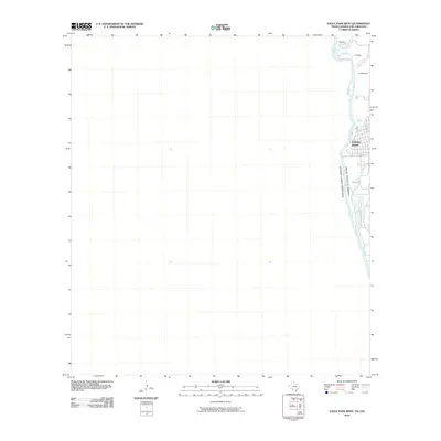
2010 Map of Eagle Pass West
USGS Topo · Published 2010About this map
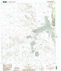
The Rio Grande serves as the central boundary in this international borderland survey, separating the United States Of America from Estados Unidos Mexicanos. On the eastern bank, the urban grid of Eagle Pass dominates the landscape, featuring residential developments and streets like N Ceylon St. The map illustrates the town's position at a critical crossing point between Texas and Coahuila. To the north of the city, several family names appear along the river's edge, including J Ritche, F Ritche, and P DeBonner, indicating small-scale land holdings or residences. The hydrological character of the region is defined by the confluence of Elm Creek and Seco Creek as they approach the main river channel, highlighting the natural drainage patterns that have historically influenced settlement near this high-desert waterway.
Find a feature on this map
10 named features on this map. Tap any name to fly to it.
Don’t see what you’re looking for? This feature index may not catch every label — zoom into the map to look around manually.
Map Details
Editions of this 2010 Eagle Pass West Map
This is the sole edition of this map. No revisions or reprints were ever made.
Other maps of this area

1940 · Eagle Pass
USGS Topo · 1:62,500

1940 · Paloma
USGS Topo · 1:62,500

1940 · Quemado
USGS Topo · 1:62,500

1958 · Eagle Pass
USGS Topo · 1:250,000

1965 · Eagle Pass
USGS Topo · 1:250,000
1974 · Deadmans Hill
USGS Topo · 1:24,000
1974 · Quemado SE
USGS Topo · 1:24,000
1983 · Eagle Pass East
USGS Topo · 1:24,000
1983 · Eagle Pass West
USGS Topo · 1:24,000
1983 · Eagle Pass SW
USGS Topo · 1:24,000