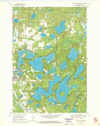
1970 Map of Eagle River East
USGS Topo · Published 1972About this map
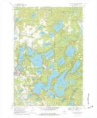
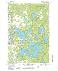
The Eagle River chain of lakes dominates this 1970 landscape, illustrating a premier Wisconsin vacation destination in its mid-century maturity. Numerous lakeside camps and recreation sites, including Camp Manito-wish, Camp Hiawatha, and Honey Rock Camp, are established among the complex waterways of Eagle Lake and Voyageur Lake. The topography reveals the intricate connection between the Chicago and North Western railroad corridor and the local economy, passing right through the heart of the settlement. North of the town center, the Nicolet National Forest provides a woodland backdrop to smaller water bodies like Deerskin Lake and Caspian Lake. On the southern edge of the chain, the Burnt Rollways Dam regulates the water levels that define the region's character, while local landmarks such as the Drive-in Theater and the town Cem ground the area's social history.
Find a feature on this map
69 named features on this map. Tap any name to fly to it.
Don’t see what you’re looking for? This feature index may not catch every label — zoom into the map to look around manually.
Map Details
Editions of this 1970 Eagle River East Map
3 editions found
Other maps of this area

1928 · Three Lakes
USGS Topo · 1:48,000

1930 · Robbins
USGS Topo · 1:48,000

1938 · Phelps
USGS Topo · 1:48,000

1938 · Three Lakes
USGS Topo · 1:48,000

1938 · Robbins
USGS Topo · 1:48,000

1945 · Three Lakes
USGS Topo · 1:48,000

1945 · Robbins
USGS Topo · 1:48,000

1946 · Star Lake
USGS Topo · 1:48,000

1950 · Phelps
USGS Topo · 1:48,000

1950 · Star Lake
USGS Topo · 1:48,000