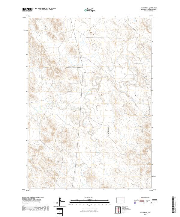
2021 Map of Eagle Rock
USGS Topo · Published 2021About this map
Eagle Rock stands as a prominent landmark in this segment of Campbell County, presiding over a landscape defined by the winding course of the Belle Fourche River. This 2021 survey illustrates a sparse ranching and energy-producing region, where a network of gravel and utility roads provides the primary infrastructure. Small tributaries including Threemile Cr and Hay Cr drain into the river valley, marking the low points of the high plains terrain. The map provides a clear look at the modern land management grid, documented through township and range boundaries such as t46n r72w and t46n r71w. Local transport is facilitated by long-established routes like Hilight Rd and Wagensen Rd, which connect isolated homesteads and work sites across the drainage basins.
Find a feature on this map
14 named features on this map. Tap any name to fly to it.
Don’t see what you’re looking for? This feature index may not catch every label — zoom into the map to look around manually.
Map Details
Editions of this 2021 Eagle Rock Map
This is the sole edition of this map. No revisions or reprints were ever made.
Other maps of this area

1954 · Gillette
USGS Topo · 1:250,000

1955 · Newcastle
USGS Topo · 1:250,000

1955 · Gillette
USGS Topo · 1:250,000

1958 · Gillette
USGS Topo · 1:250,000

1958 · Newcastle
USGS Topo · 1:250,000

1959 · North Star School
USGS Topo · 1:62,500

1962 · Gillette
USGS Topo · 1:250,000

1971 · Scaper Reservoir
USGS Topo · 1:24,000

1971 · The Gap SW
USGS Topo · 1:24,000

1971 · Reno Junction
USGS Topo · 1:24,000