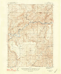
1948 Map of Eagle Rock
USGS Topo · Published 1948About this map
Crooked River carves a winding path through this Crook County landscape, defining a ranching economy that dominated the high desert in the mid-1940s. The map reveals a dense network of family-held properties along the water and valley floors, including Shorty Davis Ranch, Way Ranch, and Kizer Ranch. The presence of the Bailey Sch near the river indicates the focal point of a rural community that once relied on these scattered outposts for education and social gathering.
Find a feature on this map
44 named features on this map. Tap any name to fly to it.
Don’t see what you’re looking for? This feature index may not catch every label — zoom into the map to look around manually.
Map Details
Editions of this 1948 Eagle Rock Map
2 editions found
Other maps of this area

1946 · Eagle Rock
USGS Topo · 1:62,500

1948 · Eagle Rock
USGS Topo · 1:62,500

1948 · Ochoco Reservoir
USGS Topo · 1:62,500

1950 · Ochoco Reservoir
USGS Topo · 1:62,500

1951 · Post
USGS Topo · 1:62,500

1951 · Lookout Mtn
USGS Topo · 1:62,500

1955 · Crescent
USGS Topo · 1:250,000

1955 · Bend
USGS Topo · 1:250,000

1957 · Crescent
USGS Topo · 1:250,000

1957 · Bend
USGS Topo · 1:250,000