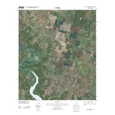
2012 Map of Eagle Springs
USGS Topo · Published 2012About this map
Belton Lake dominates the southern reaches of this landscape where the Leon River winds through Horseshoe Bend. The rural character of the region is defined by a network of farm roads and county lines, connecting small central Texas settlements like Whitson and Meador Grove. Genealogists will find a high density of burial grounds throughout the area, including Station Creek Cem, Eagle Springs Cem, and the Moody Leon Cem. The mapping shows a transition from the agricultural uplands toward the riparian lowlands of the river valley. To the east, the community of Stampede sits near the crossing of Stampede Cr, while landmarks like the Tick Hill Airfield reflect more contemporary land use amidst these longstanding rural townships.
Find a feature on this map
56 named features on this map. Tap any name to fly to it.
Don’t see what you’re looking for? This feature index may not catch every label — zoom into the map to look around manually.
Map Details
Editions of this 2012 Eagle Springs Map
This is the sole edition of this map. No revisions or reprints were ever made.
Other maps of this area

1892 · Temple
USGS Topo · 1:125,000

1894 · Gatesville
USGS Topo · 1:125,000

1924 · Gatesville 4-a
USGS Topo · 1:48,000

1924 · Temple 2-C
USGS Topo · 1:48,000

1924 · Temple 3-B
USGS Topo · 1:48,000

1930 · Killeen
USGS Topo · 1:62,500

1931 · Mc Gregor
USGS Topo · 1:62,500

1931 · Belton
USGS Topo · 1:62,500

1947 · Bland
USGS Topo · 1:24,000

1947 · Killeen
USGS Topo · 1:62,500