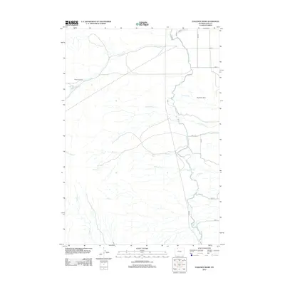
2012 Map of Eaglenest Basin
USGS Topo · Published 2012About this map
The Eaglenest Basin dominates this landscape in Park County, where the high plains meet a complex network of water management and livestock grazing history. The Heart Mountain Canal snakes along the eastern edge of the basin, representing the critical role of irrigation in the development of northern Wyoming. A network of rural lanes and county roads, such as Road 22 and Co Hwy R23, provides access to the ranching country surrounding Bishop Cow Camp. This settlement point sits near the Alkali Creek Reservoir, a vital source of water in a region defined by ephemeral and perennial streams like Alkali Cr Patch and Buck Springs Cr. The map details a rugged drainage system where creeks like Iron Cr, Snake Cr, and Idaho Cr carve through the basin floor, illustrating the geological character of this high-elevation terrain.
Find a feature on this map
27 named features on this map. Tap any name to fly to it.
Don’t see what you’re looking for? This feature index may not catch every label — zoom into the map to look around manually.
Map Details
Editions of this 2012 Eaglenest Basin Map
This is the sole edition of this map. No revisions or reprints were ever made.
Other maps of this area

1949 · Cody
USGS Topo · 1:62,500

1950 · Clark
USGS Topo · 1:62,500

1951 · Cody
USGS Topo · 1:62,500

1955 · Cody
USGS Topo · 1:250,000

1958 · Cody
USGS Topo · 1:250,000

1962 · Cody
USGS Topo · 1:250,000

1966 · Elk Basin SW
USGS Topo · 1:24,000

1966 · Corbett Dam
USGS Topo · 1:24,000
1966 · Vocation
USGS Topo · 1:24,000

1980 · Cody
USGS Topo · 1:100,000