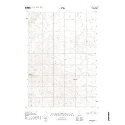
2017 Map of Eaglenest Basin
USGS Topo · Published 2017About this map
Heart Mtn dominates the southwestern corner of this high-desert landscape in Park County, where the terrain drops away into the namesake Eaglenest Basin. This 2017 study illustrates the complex irrigation network vital to the region's agricultural viability, featuring the primary Heart Mountain Canal alongside numerous lateral lines like Lateral H-105 and Lateral H-80. The map documents a rugged drainage system where ephemeral streams such as Buck Springs Cr, Iron Cr, and Question Cr carve through the arid benches. To the northeast, the land levels out toward the Ralston Flats, while the presence of the Alkali Cr Reservoir highlights the managed water resources essential for maintaining life and industry in the shadow of the Absaroka Range foothills.
Find a feature on this map
30 named features on this map. Tap any name to fly to it.
Don’t see what you’re looking for? This feature index may not catch every label — zoom into the map to look around manually.
Map Details
Editions of this 2017 Eaglenest Basin Map
This is the sole edition of this map. No revisions or reprints were ever made.
Other maps of this area

1949 · Cody
USGS Topo · 1:62,500

1950 · Clark
USGS Topo · 1:62,500

1951 · Cody
USGS Topo · 1:62,500

1955 · Cody
USGS Topo · 1:250,000

1958 · Cody
USGS Topo · 1:250,000

1962 · Cody
USGS Topo · 1:250,000

1966 · Elk Basin SW
USGS Topo · 1:24,000

1966 · Corbett Dam
USGS Topo · 1:24,000
1966 · Vocation
USGS Topo · 1:24,000

1980 · Cody
USGS Topo · 1:100,000