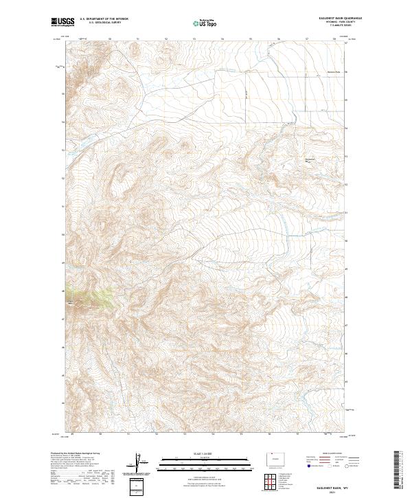
2021 Map of Eaglenest Basin
USGS Topo · Published 2021About this map
Heart Mtn dominates the southwestern corner of this landscape, where the terrain falls away toward the intricate drainage networks of Eaglenest Basin. The land here is defined by a sophisticated water management system designed to support agriculture in this high-desert environment. The presence of the Heart Mountain Canal, along with specialized irrigation features like Lateral H-105 and Lateral H-89, reveals the engineering required to move water across the Ralston Flats. Numerous seasonal watercourses, including S Eaglenest Cr, Buck Springs Cr, and Question Cr, carve through the basin, illustrating the natural watershed that precedes the irrigation works. Near the northern boundary, the Alkali Cr Reservoir and various road segments like Rattler Rd and Canal Rd further mark the intersection of natural topography and human infrastructure in Park County.
Find a feature on this map
32 named features on this map. Tap any name to fly to it.
Don’t see what you’re looking for? This feature index may not catch every label — zoom into the map to look around manually.
Map Details
Editions of this 2021 Eaglenest Basin Map
This is the sole edition of this map. No revisions or reprints were ever made.
Other maps of this area

1949 · Cody
USGS Topo · 1:62,500

1950 · Clark
USGS Topo · 1:62,500

1951 · Cody
USGS Topo · 1:62,500

1955 · Cody
USGS Topo · 1:250,000

1958 · Cody
USGS Topo · 1:250,000

1962 · Cody
USGS Topo · 1:250,000

1966 · Elk Basin SW
USGS Topo · 1:24,000

1966 · Corbett Dam
USGS Topo · 1:24,000
1966 · Vocation
USGS Topo · 1:24,000

1980 · Cody
USGS Topo · 1:100,000