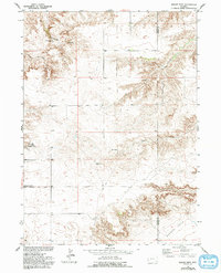
1951 Map of Eagles Nest
USGS Topo · Published 1993About this map
Eagles Nest and the surrounding high plains of Platte County are documented here as they appeared in the early 1950s. The landscape is defined by its drainage systems, including Cottonwood Draw and Little Cottonwood Creek, which carve through the high ground towards the Goshen Hole escarpment in the southeast. A notable cultural landmark is the Antelope Grange Hall, situated near Antelope Gap Road, reflecting the importance of agricultural community hubs during this era of rural Wyoming history.
Find a feature on this map
12 named features on this map. Tap any name to fly to it.
Don’t see what you’re looking for? This feature index may not catch every label — zoom into the map to look around manually.
Map Details
Editions of this 1951 Eagles Nest Map
3 editions found
Other maps of this area

1896 · Hartville
USGS Topo · 1:125,000

1901 · Hartville
USGS Topo · 1:125,000

1950 · Rockeagle
USGS Topo · 1:24,000

1950 · Fort Laramie
USGS Topo · 1:24,000

1950 · Register Cliff
USGS Topo · 1:24,000

1951 · Antelope Gap
USGS Topo · 1:24,000
1951 · Wheatland NE
USGS Topo · 1:24,000

1951 · Eagles Nest
USGS Topo · 1:24,000

1952 · Register Cliff
USGS Topo · 1:24,000

1952 · Fort Laramie
USGS Topo · 1:24,000