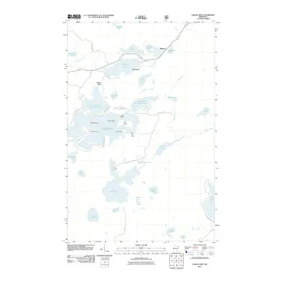
2011 Map of Eagles Nest
USGS Topo · Published 2011About this map
Bear Head Lake State Park dominates the southern half of this landscape, preserving a dense network of water bodies and islands in northern Minnesota. This 2011 survey illustrates the complex geography of the Eagles Nest region, where the interconnected basins of Eagles Nest Lake Number One, Eagles Nest Lake Number Three, and Eagles Nest Lake Number Four are separated by features like Stocking Point and Howes Point. Small settlements such as Robinson and McComber sit along the northern road corridors, while the winding courses of the Armstrong River and Beaver River drain the surrounding wetlands. This map provides a detailed view of seasonal access and shoreline development, naming numerous islands like Bear Island and Big Toe Island that reflect the area's history as a destination for recreation and isolation in the lake country.
Find a feature on this map
48 named features on this map. Tap any name to fly to it.
Don’t see what you’re looking for? This feature index may not catch every label — zoom into the map to look around manually.
Map Details
Editions of this 2011 Eagles Nest Map
This is the sole edition of this map. No revisions or reprints were ever made.
Other maps of this area

1933 · Ely
USGS Topo · 1:62,500

1939 · Ely
USGS Topo · 1:62,500

1949 · Isaac Lake
USGS Topo · 1:24,000

1949 · Embarrass
USGS Topo · 1:24,000

1950 · Isaac Lake
USGS Topo · 1:24,000

1950 · Embarrass
USGS Topo · 1:24,000

1951 · Babbitt
USGS Topo · 1:24,000

1954 · Two Harbors
USGS Topo · 1:250,000

1954 · Hibbing
USGS Topo · 1:250,000

1956 · Chad Lake
USGS Topo · 1:24,000