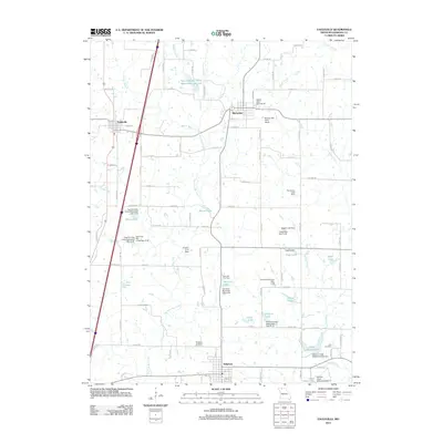
2012 Map of Eagleville
USGS Topo · Published 2012About this map
Ridgeway and Eagleville anchor this northern Missouri landscape, characterized by an extensive network of small reservoirs and watershed management structures. The area is defined by the winding course of the East Fork Big Creek and its tributaries, including Barber Branch and Brush Creek. A high density of named water bodies, such as Gibson Lake, Rock House Lake, and Tripp Lake, reveals a complex system of local dams and conservation pools like Tuggles Dam and the Fitz Farms Lake Dam.
Find a feature on this map
101 named features on this map. Tap any name to fly to it.
Don’t see what you’re looking for? This feature index may not catch every label — zoom into the map to look around manually.
Map Details
Editions of this 2012 Eagleville Map
This is the sole edition of this map. No revisions or reprints were ever made.
Other maps of this area

1945 · Mount Ayr
USGS Topo · 1:62,500

1945 · Lamoni
USGS Topo · 1:62,500

1947 · Lamoni
USGS Topo · 1:62,500

1947 · Blythedale
USGS Topo · 1:62,500

1947 · Mount Ayr
USGS Topo · 1:62,500

1948 · Bethany
USGS Topo · 1:62,500

1954 · Centerville
USGS Topo · 1:250,000

1955 · Nebraska City
USGS Topo · 1:250,000

1957 · Nebraska City
USGS Topo · 1:250,000

1957 · Centerville
USGS Topo · 1:250,000