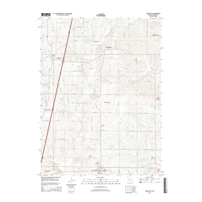
2015 Map of Eagleville
USGS Topo · Published 2015About this map
Ridgeway and Eagleville anchor this northern Missouri landscape, where the headwaters of the E Fork Big Cr and its tributaries carve a network of ridges and small valleys. The map reveals a high density of small, private reservoirs and named water bodies such as Gibson Lake, Meinecke Lake, and Fitz Farms Lake, which punctuate the agricultural terrain. This pattern of water management is characteristic of the region's 21st-century rural layout, supporting local farming and land use. For those researching family history in Harrison County, the map provides precise locations for several burial grounds, including Rose Hill Cemetery and Lilly Cemetery. The northern settlement of Blythedale sits just below the Iowa border, connected to the southern towns by a grid of numbered section roads that follow the township lines of the Public Land Survey System, illustrating the enduring structural influence of 19th-century land divisions on modern infrastructure.
Find a feature on this map
71 named features on this map. Tap any name to fly to it.
Don’t see what you’re looking for? This feature index may not catch every label — zoom into the map to look around manually.
Map Details
Editions of this 2015 Eagleville Map
This is the sole edition of this map. No revisions or reprints were ever made.
Other maps of this area

1945 · Mount Ayr
USGS Topo · 1:62,500

1945 · Lamoni
USGS Topo · 1:62,500

1947 · Lamoni
USGS Topo · 1:62,500

1947 · Blythedale
USGS Topo · 1:62,500

1947 · Mount Ayr
USGS Topo · 1:62,500

1948 · Bethany
USGS Topo · 1:62,500

1954 · Centerville
USGS Topo · 1:250,000

1955 · Nebraska City
USGS Topo · 1:250,000

1957 · Nebraska City
USGS Topo · 1:250,000

1957 · Centerville
USGS Topo · 1:250,000