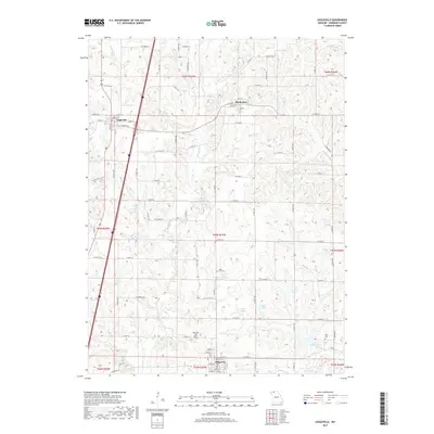
2017 Map of Eagleville
USGS Topo · Published 2017About this map
Eagleville and Ridgeway anchor this Harrison County landscape, where the E Fork Big Cr and its various tributaries have carved a rolling terrain filled with small reservoirs. The map reveals a highly structured agricultural grid, where rural life revolves around the water provided by dozens of small impoundments such as Fitz Farms Lake, Rock House Lake, and Jesse Hale Lake. The placement of Rose Hill Cem, Ridgeway Cem, and Lilly Cem suggests a long-standing community footprint, with family and local history deeply tied to these specific sections. Interstate 35 cuts a modern path north to south, contrasting with the traditional town layouts of Blythedale and the street grids of the larger settlements. This documentation of the area's hydrography and rural cemetery locations provides an essential resource for those tracing local land use or family genealogy in northern Missouri.
Find a feature on this map
70 named features on this map. Tap any name to fly to it.
Don’t see what you’re looking for? This feature index may not catch every label — zoom into the map to look around manually.
Map Details
Editions of this 2017 Eagleville Map
This is the sole edition of this map. No revisions or reprints were ever made.
Other maps of this area

1945 · Mount Ayr
USGS Topo · 1:62,500

1945 · Lamoni
USGS Topo · 1:62,500

1947 · Lamoni
USGS Topo · 1:62,500

1947 · Blythedale
USGS Topo · 1:62,500

1947 · Mount Ayr
USGS Topo · 1:62,500

1948 · Bethany
USGS Topo · 1:62,500

1954 · Centerville
USGS Topo · 1:250,000

1955 · Nebraska City
USGS Topo · 1:250,000

1957 · Nebraska City
USGS Topo · 1:250,000

1957 · Centerville
USGS Topo · 1:250,000