
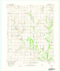
1961 Map of Eakly
USGS Topo · Published 1962About this map
Colony and Eakly anchor this 1961 survey of Caddo and Washita counties, a region defined by its red-soil creek valleys and rural social centers. The landscape is dotted with community landmarks like the Indian Cem and Mound Valley Sch, reflecting a long history of local settlement and faith. Water management is a central theme, evidenced by the recently established Fort Cobb Reservoir in the southeast corner and numerous smaller impoundments such as Crowder Lake and Worth Richmond Lake. Numerous quarries and a Strip Mine near Cowden Junction reveal the area's extractive economy. Named terrain features like Twin Mounds and Ghost Mound provide distinctive navigational markers across the varied topography of the Cobb Creek and Fivemile Creek drainage systems.
Find a feature on this map
61 named features on this map. Tap any name to fly to it.
Don’t see what you’re looking for? This feature index may not catch every label — zoom into the map to look around manually.
Map Details
Editions of this 1961 Eakly Map
2 editions found
Other maps of this area

1942 · Geary
USGS Topo · 1:62,500

1951 · Binger
USGS Topo · 1:62,500

1951 · Fort Cobb
USGS Topo · 1:62,500

1955 · Clinton
USGS Topo · 1:250,000

1956 · Cordell
USGS Topo · 1:62,500

1957 · Clinton
USGS Topo · 1:250,000

1957 · Clinton
USGS Topo · 1:62,500

1961 · Gotebo
USGS Topo · 1:62,500

1961 · Carnegie
USGS Topo · 1:62,500

1964 · Weatherford
USGS Topo · 1:62,500