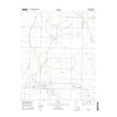
2014 Map of Earle
USGS Topo · Published 2014About this map
Gibson Bayou and the Tyronza River wind through this corner of the Arkansas Delta, defining a landscape shaped by drainage and agriculture. The city of Earle serves as the primary hub, surrounded by smaller settlements like Norvell, Shannonville, and Cloar. This area is particularly rich in genealogical data, featuring numerous burial grounds such as Gibson Bayou Cem, Cloar Cem, and Spring Hill Cem. North of the main settlement areas, the terrain is marked by distinct water bodies including Beautiful Lake, Little Grassy Lake, and the expansive Grassy Lake Bottom. The presence of Mc Neely Airport and the local road network, including the Twist Hwy and Yellow Store Rd, illustrates the connectivity of these rural communities and their reliance on the fertile lowlands between the bayous.
Find a feature on this map
78 named features on this map. Tap any name to fly to it.
Don’t see what you’re looking for? This feature index may not catch every label — zoom into the map to look around manually.
Map Details
Editions of this 2014 Earle Map
This is the sole edition of this map. No revisions or reprints were ever made.
Other maps of this area

1939 · Edmondson
USGS Topo · 1:62,500

1940 · Deckerville
USGS Topo · 1:62,500

1940 · Princedale
USGS Topo · 1:62,500

1940 · Whitmore
USGS Topo · 1:62,500

1953 · Memphis
USGS Topo · 1:250,000

1954 · Edmondson
USGS Topo · 1:62,500

1956 · Memphis
USGS Topo · 1:250,000

1956 · Whitmore
USGS Topo · 1:62,500

1956 · Princedale
USGS Topo · 1:62,500

1957 · Deckerville
USGS Topo · 1:62,500