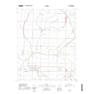
2020 Map of Earle
USGS Topo · Published 2020About this map
Earle serves as the central hub of this eastern Arkansas landscape, where the town's grid meets a network of watercourses and agrarian tracts. The surrounding countryside is defined by the winding paths of the Tyronza River and Blackfish Bayou, which create a complex drainage pattern across the flat Delta terrain. Numerous rural burial grounds are scattered throughout the territory, including Hood Cem, Gibson Bayou Cem, and Spring Hill Cem, often situated near small settlements or road junctions like Three Forks and Cloar. This 2020 map documents the persistent agricultural character of Crittenden County, where old routes like Yellow Store Rd and WPA Rd connect long-standing farms. Further south, Stokes Airport and the community of Lansing sit near the extensive wetlands of Grassy Lake Bottom, illustrating how local infrastructure is shaped by the low-lying geography of the Mississippi Embayment.
Find a feature on this map
90 named features on this map. Tap any name to fly to it.
Don’t see what you’re looking for? This feature index may not catch every label — zoom into the map to look around manually.
Map Details
Editions of this 2020 Earle Map
This is the sole edition of this map. No revisions or reprints were ever made.
Other maps of this area

1939 · Edmondson
USGS Topo · 1:62,500

1940 · Deckerville
USGS Topo · 1:62,500

1940 · Princedale
USGS Topo · 1:62,500

1940 · Whitmore
USGS Topo · 1:62,500

1953 · Memphis
USGS Topo · 1:250,000

1954 · Edmondson
USGS Topo · 1:62,500

1956 · Memphis
USGS Topo · 1:250,000

1956 · Whitmore
USGS Topo · 1:62,500

1956 · Princedale
USGS Topo · 1:62,500

1957 · Deckerville
USGS Topo · 1:62,500