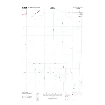
2013 Map of Earlham West
USGS Topo · Published 2013About this map
Earlham serves as the primary municipal anchor at the northeastern corner of this Iowa landscape, where the town’s grid meets the rural expanse of Madison County. The terrain is defined by the winding course of the North River and its various tributaries, including the N Br N River, Tom Cr, and Jim Cr. These waterways carve soft valleys through a strictly partitioned agricultural landscape organized by a network of rural routes such as Creamery Rd and Cottonwood Ave.
Find a feature on this map
38 named features on this map. Tap any name to fly to it.
Don’t see what you’re looking for? This feature index may not catch every label — zoom into the map to look around manually.
Map Details
Editions of this 2013 Earlham West Map
This is the sole edition of this map. No revisions or reprints were ever made.
Other maps of this area

1949 · Adel
USGS Topo · 1:62,500

1951 · Adel
USGS Topo · 1:62,500

1952 · Panora
USGS Topo · 1:62,500

1952 · Winterset
USGS Topo · 1:62,500

1954 · Greenfield
USGS Topo · 1:62,500

1954 · Omaha
USGS Topo · 1:250,000

1957 · Omaha
USGS Topo · 1:250,000

1958 · Omaha
USGS Topo · 1:250,000
1982 · Redfield
USGS Topo · 1:24,000
1982 · Adel
USGS Topo · 1:24,000