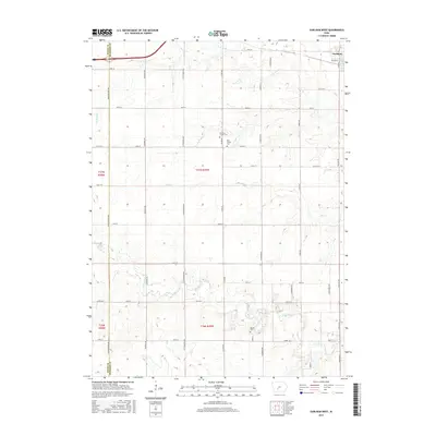
2015 Map of Earlham West
USGS Topo · Published 2015About this map
The Earlham town site occupies the northeast corner of this Madison County landscape, where the local road grid meets the rolling drainages of the North River. The geography is defined by the branching waterways of the N Br N River and Tom Cr, which carve through the agricultural sections of Township 77 North and Township 76 North. This area preserves several localized burial sites that offer significant value for genealogical research, including the Old Penn Center Cem and the adjacent Penn Center Cem situated along Pitzer Road. Further south, the Eppard Cem sits near the winding course of the main river. The map details a dense network of county thoroughfares, such as Co Rd G15 and Co Rd G27, which have historically connected these rural farmsteads and cemeteries to the regional hub at Earlham.
Find a feature on this map
30 named features on this map. Tap any name to fly to it.
Don’t see what you’re looking for? This feature index may not catch every label — zoom into the map to look around manually.
Map Details
Editions of this 2015 Earlham West Map
This is the sole edition of this map. No revisions or reprints were ever made.
Other maps of this area

1949 · Adel
USGS Topo · 1:62,500

1951 · Adel
USGS Topo · 1:62,500

1952 · Panora
USGS Topo · 1:62,500

1952 · Winterset
USGS Topo · 1:62,500

1954 · Greenfield
USGS Topo · 1:62,500

1954 · Omaha
USGS Topo · 1:250,000

1957 · Omaha
USGS Topo · 1:250,000

1958 · Omaha
USGS Topo · 1:250,000
1982 · Redfield
USGS Topo · 1:24,000
1982 · Adel
USGS Topo · 1:24,000