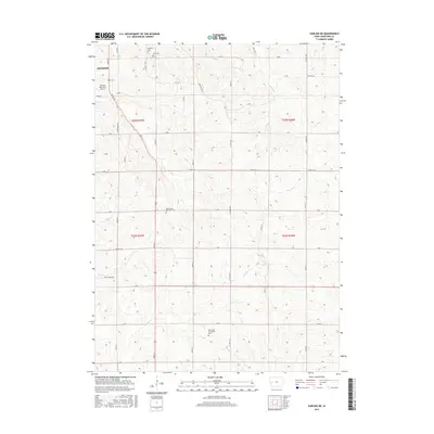
2015 Map of Earling NE
USGS Topo · Published 2015About this map
Denison anchors the northwest corner of this 2015 survey, where the Denison Municipal Airport sits near the intersection of Hwy 59 / 141 and Coon Grove Ln. The landscape is defined by the agricultural grid of Crawford County, dissected by a dendritic drainage system including Coon Cr, Walnut Cr, and Willow Cr. This map is particularly valuable for genealogical research, as it identifies several local burial grounds such as Oakland Cem, Zion Cem, and the Emmanuel Evangelical Cem further south.
Find a feature on this map
43 named features on this map. Tap any name to fly to it.
Don’t see what you’re looking for? This feature index may not catch every label — zoom into the map to look around manually.
Map Details
Editions of this 2015 Earling NE Map
This is the sole edition of this map. No revisions or reprints were ever made.
Other maps of this area

1954 · Omaha
USGS Topo · 1:250,000

1954 · Fort Dodge
USGS Topo · 1:250,000

1957 · Omaha
USGS Topo · 1:250,000

1957 · Fort Dodge
USGS Topo · 1:250,000

1958 · Omaha
USGS Topo · 1:250,000

1958 · Fort Dodge
USGS Topo · 1:250,000

1971 · Earling
USGS Topo · 1:24,000

1971 · Earling NE
USGS Topo · 1:24,000

1971 · Denison
USGS Topo · 1:24,000
1971 · Dow City
USGS Topo · 1:24,000