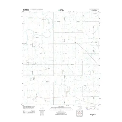
2012 Map of Earlsboro
USGS Topo · Published 2012About this map
East Shawnee Oil Field and the surrounding energy landscape define this portion of Pottawatomie County during the early 21st century. The map reveals an area where industrial development for petroleum extraction exists alongside established rural communities. The town of Earlsboro serves as a central hub, while the smaller settlement of Neal sits further north along the Hwy 3 corridor. Significant oil production zones like the Victory Hill Oil Field and Northwest Earlsboro Oil Field are interspersed with local heritage sites, including the Resthaven Cem and Earlsboro Cem.
Find a feature on this map
69 named features on this map. Tap any name to fly to it.
Don’t see what you’re looking for? This feature index may not catch every label — zoom into the map to look around manually.
Map Details
Editions of this 2012 Earlsboro Map
This is the sole edition of this map. No revisions or reprints were ever made.
Other maps of this area

1896 · Seminole and Prague
USGS Topo · 1:125,000

1907 · Maud
USGS Topo · 1:62,500

1908 · Maud
USGS Topo · 1:62,500

1909 · Shawnee
USGS Topo · 1:62,500

1954 · Oklahoma City
USGS Topo · 1:250,000

1957 · Oklahoma City
USGS Topo · 1:250,000

1963 · Oklahoma City
USGS Topo · 1:250,000

1967 · Prague SW
USGS Topo · 1:24,000
1967 · Shawnee
USGS Topo · 1:24,000
1967 · Earlsboro
USGS Topo · 1:24,000