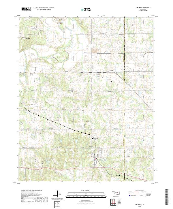
2022 Map of Earlsboro
USGS Topo · Published 2022About this map
Earlsboro sits at the center of this landscape, situated along the border of Pottawatomie and Seminole Counties. The town is flanked by historic sites including Earlsboro Cem and the Earlsboro Cemetery African American, reflecting the deep community roots of the region. To the northwest, the edge of Shawnee appears, while the settlement of Neal is positioned east of the primary town site.
Find a feature on this map
92 named features on this map. Tap any name to fly to it.
Don’t see what you’re looking for? This feature index may not catch every label — zoom into the map to look around manually.
Map Details
Editions of this 2022 Earlsboro Map
This is the sole edition of this map. No revisions or reprints were ever made.
Other maps of this area

1896 · Seminole and Prague
USGS Topo · 1:125,000

1907 · Maud
USGS Topo · 1:62,500

1908 · Maud
USGS Topo · 1:62,500

1909 · Shawnee
USGS Topo · 1:62,500

1954 · Oklahoma City
USGS Topo · 1:250,000

1957 · Oklahoma City
USGS Topo · 1:250,000

1963 · Oklahoma City
USGS Topo · 1:250,000

1967 · Prague SW
USGS Topo · 1:24,000
1967 · Shawnee
USGS Topo · 1:24,000
1967 · Earlsboro
USGS Topo · 1:24,000