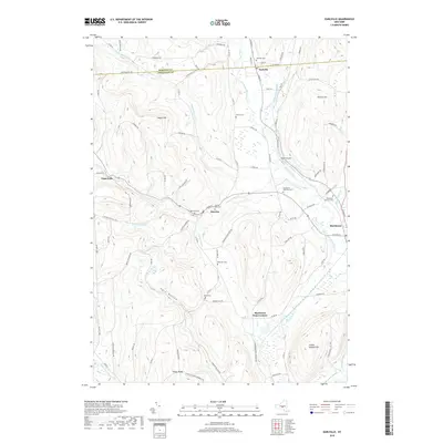
2019 Map of Earlville
USGS Topo · Published 2019About this map
The Chenango River and Sangerfield River converge in this landscape along the border of Madison and Chenango Counties. This area is defined by its small villages and crossroad settlements, including Earlville, Smyrna, and Sherburne Four Corners, connected by a network of county roads and historical main streets. The terrain is marked by significant rises such as Negro Hill and Steam Sawmill Hill, while Dark Hollow and Tinker Ridge suggest the topographic variety that shaped local settlement patterns. Genealogists will find a high density of burial grounds, including the Earlville Cemetery, Sherburne West Hill Cemetery, and the Smyrna East Cemetery. The presence of Morin Airport and various brooks like Pleasant Brook and Crooked Brook highlights the blend of modern utility and the natural drainage systems that have historically supported this dairy and agricultural region.
Find a feature on this map
90 named features on this map. Tap any name to fly to it.
Don’t see what you’re looking for? This feature index may not catch every label — zoom into the map to look around manually.
Map Details
Editions of this 2019 Earlville Map
This is the sole edition of this map. No revisions or reprints were ever made.
Other maps of this area

1902 · Morrisville
USGS Topo · 1:62,500

1903 · Norwich
USGS Topo · 1:62,500

1907 · Sangerfield
USGS Topo · 1:62,500

1910 · New Berlin
USGS Topo · 1:62,500

1912 · New Berlin
USGS Topo · 1:62,500

1943 · Otselic
USGS Topo · 1:24,000

1943 · West Eaton
USGS Topo · 1:24,000

1943 · Hubbardsville
USGS Topo · 1:24,000

1943 · Sangerfield
USGS Topo · 1:62,500

1943 · Holmesville
USGS Topo · 1:24,000