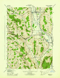
1944 Map of Earlville
USGS Topo · Published 1944About this map
The Chenango River valley serves as a busy corridor for transit and agriculture during the mid-1940s, anchored by the village of Earlville. Dual rail lines, the New York Ontario and Western RR and the Delaware Lackawanna and Western RR, parallel the river's course, connecting the valley's dairy and poultry farms to wider markets. The landscape is defined by its transition from the flat river valley into the surrounding uplands, such as Nigger Hill and Steam Sawmill Hill, where numerous small rural schools like School No 1 and School No 3 suggest a decentralized rural population. Local history is deeply embedded in the land through named family and community burial grounds, including Wilcox Cem and Quaker Cem, while the Rogers State Game Farm near Sherburne highlights the state's early conservation efforts in Chenango County.
Find a feature on this map
39 named features on this map. Tap any name to fly to it.
Don’t see what you’re looking for? This feature index may not catch every label — zoom into the map to look around manually.
Map Details
Editions of this 1944 Earlville Map
This is the sole edition of this map. No revisions or reprints were ever made.
Other maps of this area

1902 · Morrisville
USGS Topo · 1:62,500

1903 · Norwich
USGS Topo · 1:62,500

1907 · Sangerfield
USGS Topo · 1:62,500

1910 · New Berlin
USGS Topo · 1:62,500

1912 · New Berlin
USGS Topo · 1:62,500

1943 · Otselic
USGS Topo · 1:24,000

1943 · West Eaton
USGS Topo · 1:24,000

1943 · Hubbardsville
USGS Topo · 1:24,000

1943 · Sangerfield
USGS Topo · 1:62,500

1943 · Holmesville
USGS Topo · 1:24,000