1980 Map of Early
USGS Topo · Published 1980About this map
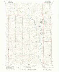
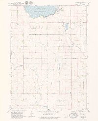
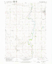
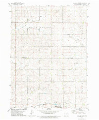
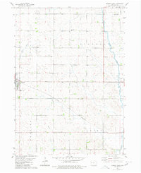
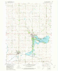
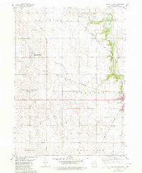
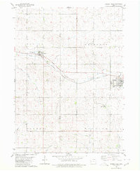
Early serves as the central hub of this agricultural landscape in Sac County, Iowa, positioned where the Chicago and North Western railroad crosses the plains. The town's institutional history is visible through the presence of Sacred Heart Sch and the Immanuel Ch, while the surrounding sections are organized into distinct townships including Eden, Cook, and Boyer Valley. The natural geography is defined by the winding course of the Boyer River, which meanders south past Reiff Park and its accompanying campground. Local infrastructure and land use are reflected in features such as the sewage disposal ponds and several scattered gravel pits, indicating the area's rural utility during the late twentieth century. Genealogists will find the locations of the Early Union Cem and Protestant Union Cem particularly useful for tracing family roots in this corner of the state.
Find a feature on this map
22 named features on this map. Tap any name to fly to it.
Don’t see what you’re looking for? This feature index may not catch every label — zoom into the map to look around manually.
Map Details
Editions of this 1980 Early Map
This is the sole edition of this map. No revisions or reprints were ever made.
Other maps of this area

1954 · Fort Dodge
USGS Topo · 1:250,000

1957 · Fort Dodge
USGS Topo · 1:250,000

1958 · Fort Dodge
USGS Topo · 1:250,000
1979 · Lakeside
USGS Topo · 1:24,000
1979 · Newell West
USGS Topo · 1:24,000
1979 · Schaller North
USGS Topo · 1:24,000
1980 · Odebolt East
USGS Topo · 1:24,000
1980 · Lake View
USGS Topo · 1:24,000
1980 · Sac City West
USGS Topo · 1:24,000
1980 · Odebolt West
USGS Topo · 1:24,000