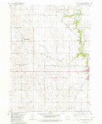
1980 Map of Sac City West
USGS Topo · Published 1980About this map
North Raccoon River drainage and the surrounding agricultural uplands define this 1980 survey of Sac County. The landscape is a study in mid-century transportation and land use, featuring the western portions of Sac City and the town of Early. Two major rail lines, the Chicago and North Western and the Chicago Milwaukee St Paul and Pacific, cross the territory, illustrating the infrastructure required to move Iowa's grain to market. Conservation areas like the Kiowa Marsh State Public Hunting Area and Kiowa Marsh occupy the low-lying glacial depressions in Boyer Valley, contrasting with the orderly section lines and numerous Gravel Pits that supported local road building. Traces of rural life are visible through scattered farmsteads and small creeks like Indian Creek, while a Golf Course and Radio Tower mark the outskirts of the county seat.
Find a feature on this map
20 named features on this map. Tap any name to fly to it.
Don’t see what you’re looking for? This feature index may not catch every label — zoom into the map to look around manually.
Map Details
Editions of this 1980 Sac City West Map
This is the sole edition of this map. No revisions or reprints were ever made.
Other maps of this area

1954 · Fort Dodge
USGS Topo · 1:250,000

1957 · Fort Dodge
USGS Topo · 1:250,000

1958 · Fort Dodge
USGS Topo · 1:250,000

1979 · Lakeside
USGS Topo · 1:24,000

1979 · Newell West
USGS Topo · 1:24,000

1979 · Newell East
USGS Topo · 1:24,000

1980 · Odebolt East
USGS Topo · 1:24,000

1980 · Sac City East
USGS Topo · 1:24,000

1980 · Grant City
USGS Topo · 1:24,000

1980 · Early
USGS Topo · 1:24,000