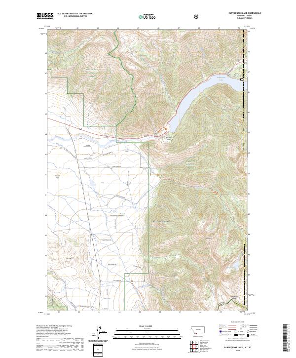
2024 Map of Earthquake Lake
USGS Topo · Published 2024About this map
Earthquake Lake dominates this rugged high-country landscape, formed by the massive 1959 seismic event that triggered the Madison Slide. The Madison River flows through the canyon floor, flanked by the Lee Metcalf Wilderness to the north and the Henrys Lake Mountains to the south. This modern survey illustrates the proximity of the Continental Divide and the intersection of the Madison and Gallatin county lines. Small settlements and ranch sites like Brown, Torry, and the Continental Divide Ranch are scattered near the river valley. The map details the network of forest roads and trails, including Sheep Creek Rd and the Sheep Lake Trl, which provide access to high-altitude features like Sheep Mtn and the isolated Sheep Lake.
Find a feature on this map
45 named features on this map. Tap any name to fly to it.
Don’t see what you’re looking for? This feature index may not catch every label — zoom into the map to look around manually.
Map Details
Editions of this 2024 Earthquake Lake Map
This is the sole edition of this map. No revisions or reprints were ever made.
Other maps of this area

1950 · Cliff Lake
USGS Topo · 1:62,500

1950 · Hebgen Dam
USGS Topo · 1:62,500

1950 · Upper Red Rock Lake
USGS Topo · 1:62,500

1955 · Ashton
USGS Topo · 1:250,000

1958 · Ashton
USGS Topo · 1:250,000

1960 · Ashton
USGS Topo · 1:250,000

1964 · Targhee Pass
USGS Topo · 1:24,000

1964 · Targhee Peak
USGS Topo · 1:24,000

1964 · Henrys Lake
USGS Topo · 1:62,500
1988 · Hidden Lake Bench
USGS Topo · 1:24,000