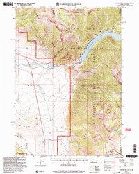
2000 Map of Earthquake Lake
USGS Topo · Published 2005About this map
Earthquake Lake dominates this rugged corner of the Madison River valley, a landscape fundamentally reshaped by the 1959 seismic event. The map documents the Madison Slide and the subsequent creation of the lake, with the Earthquake Memorial and Visitors Center serving as key landmarks for understanding the area's geomorphology. To the west, the Missouri Flats offer a stark contrast to the surrounding peaks of the Horn Mountains and Sheep Mountain.
Find a feature on this map
44 named features on this map. Tap any name to fly to it.
Don’t see what you’re looking for? This feature index may not catch every label — zoom into the map to look around manually.
Map Details
Editions of this 2000 Earthquake Lake Map
This is the sole edition of this map. No revisions or reprints were ever made.
Other maps of this area

1950 · Cliff Lake
USGS Topo · 1:62,500

1950 · Hebgen Dam
USGS Topo · 1:62,500

1950 · Upper Red Rock Lake
USGS Topo · 1:62,500

1955 · Ashton
USGS Topo · 1:250,000

1958 · Ashton
USGS Topo · 1:250,000

1960 · Ashton
USGS Topo · 1:250,000

1964 · Targhee Pass
USGS Topo · 1:24,000

1964 · Targhee Peak
USGS Topo · 1:24,000

1964 · Henrys Lake
USGS Topo · 1:62,500
1988 · Hidden Lake Bench
USGS Topo · 1:24,000