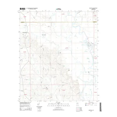
2015 Map of Easen Hill
USGS Topo · Published 2015About this map
Holly Landing sits near the confluence of Red Creek and Black Creek in this part of Mississippi. The landscape is defined by an intricate network of waterways, with numerous named branches and creeks like Alligator Br, Fourmile Br, and Fivemile Br cutting through the terrain. The topography rises at Easen Hill and Ladnier Hill, providing a contrast to the low-lying wetlands of Sandy Slough and Boggy Slough. Cultural landmarks are scattered throughout the rural landscape, including the Pine Grove Cem, White Cem, and Cain Cem, which offer significant value for genealogical research in this portion of Jackson and George Counties. Local infrastructure is represented by the Red Creek Mississippi Highway 57 Bridge and a series of named rural roads like Schoolhouse Rd and Wagon Trail Rd, tracing the movement patterns across this river-bottom territory.
Find a feature on this map
117 named features on this map. Tap any name to fly to it.
Don’t see what you’re looking for? This feature index may not catch every label — zoom into the map to look around manually.
Map Details
Editions of this 2015 Easen Hill Map
This is the sole edition of this map. No revisions or reprints were ever made.
Other maps of this area

1941 · Vancleave
USGS Topo · 1:62,500

1941 · Lucedale
USGS Topo · 1:62,500

1943 · Lucedale
USGS Topo · 1:62,500

1943 · Vancleave
USGS Topo · 1:62,500

1944 · Vancleave
USGS Topo · 1:62,500

1947 · Benndale
USGS Topo · 1:62,500

1949 · Benndale
USGS Topo · 1:62,500

1953 · Mobile
USGS Topo · 1:250,000

1954 · Vestry
USGS Topo · 1:62,500

1957 · Mobile
USGS Topo · 1:250,000