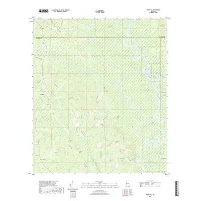
2018 Map of Easen Hill
USGS Topo · Published 2018About this map
The Pascagoula River and its intricate network of oxbow lakes and sloughs dominate this portion of the Gulf Coastal Plain along the border of George and Jackson Counties. The landscape is defined by the slow-moving waters of Black Creek, Red Creek, and the Dead River, which have carved a complex environment of wetlands and bottomlands. Prominent elevations such as Easen Hill, Carrol Hill, and the distinctive Red Bluff rise above the surrounding marshes and river bends, providing the primary ground for local development and historical cemeteries.
Find a feature on this map
82 named features on this map. Tap any name to fly to it.
Don’t see what you’re looking for? This feature index may not catch every label — zoom into the map to look around manually.
Map Details
Editions of this 2018 Easen Hill Map
This is the sole edition of this map. No revisions or reprints were ever made.
Other maps of this area

1941 · Vancleave
USGS Topo · 1:62,500

1941 · Lucedale
USGS Topo · 1:62,500

1943 · Lucedale
USGS Topo · 1:62,500

1943 · Vancleave
USGS Topo · 1:62,500

1944 · Vancleave
USGS Topo · 1:62,500

1947 · Benndale
USGS Topo · 1:62,500

1949 · Benndale
USGS Topo · 1:62,500

1953 · Mobile
USGS Topo · 1:250,000

1954 · Vestry
USGS Topo · 1:62,500

1957 · Mobile
USGS Topo · 1:250,000