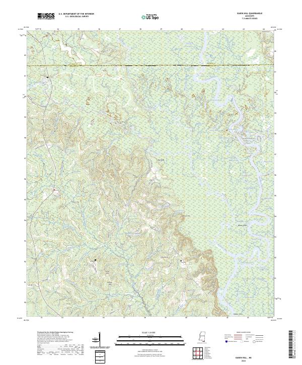
2024 Map of Easen Hill
USGS Topo · Published 2024About this map
Red Bluff stands as a prominent landmark above the extensive wetlands where Black Creek and Red Creek converge before joining the winding Pascagoula River. This modern survey of the Jackson and George county line reveals a landscape dominated by complex fluvial features, including numerous oxbows such as Ferrell Dead River and Dogged Dead River. The settlement of Easen Hill is positioned near the center of the sheet, surrounded by smaller family and community landmarks that offer significant value for genealogical research. Documented burial sites including Pine Grove Cem, Jeff White Cem, and Cain Cem are interspersed among the hills and branches. The river system's history is further reflected in traditional crossing points and landings like Holders Ferry and Webbs Point, while the terrain is marked by named rises such as Ladnier Hill and Carrol Hill.
Find a feature on this map
99 named features on this map. Tap any name to fly to it.
Don’t see what you’re looking for? This feature index may not catch every label — zoom into the map to look around manually.
Map Details
Editions of this 2024 Easen Hill Map
This is the sole edition of this map. No revisions or reprints were ever made.
Other maps of this area

1941 · Vancleave
USGS Topo · 1:62,500

1941 · Lucedale
USGS Topo · 1:62,500

1943 · Lucedale
USGS Topo · 1:62,500

1943 · Vancleave
USGS Topo · 1:62,500

1944 · Vancleave
USGS Topo · 1:62,500

1947 · Benndale
USGS Topo · 1:62,500

1949 · Benndale
USGS Topo · 1:62,500

1953 · Mobile
USGS Topo · 1:250,000

1954 · Vestry
USGS Topo · 1:62,500

1957 · Mobile
USGS Topo · 1:250,000