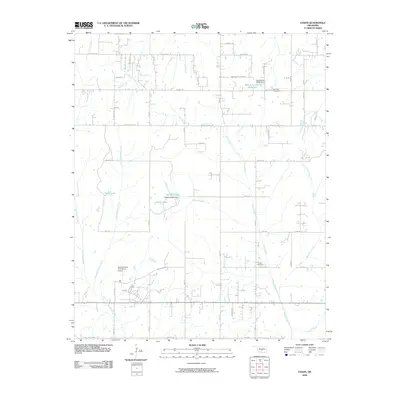
2009 Map of Eason
USGS Topo · Published 2009About this map
The creek-crossed landscape south of Norman reveals a rural geography defined by small reservoirs and established county roads. Following the path of Pond Creek and Little Buckhead Creek, the terrain is punctuated by significant water management features like Dahlgren Lake and the Oknoname 02703 Reservoir. The road network, including the namesake Slaughterville Rd, structures a community where legacy land use remains visible through well-maintained burial grounds.
Find a feature on this map
33 named features on this map. Tap any name to fly to it.
Don’t see what you’re looking for? This feature index may not catch every label — zoom into the map to look around manually.
Map Details
Editions of this 2009 Eason Map
This is the sole edition of this map. No revisions or reprints were ever made.
Other maps of this area

1893 · Norman
USGS Topo · 1:62,500

1898 · Purcell
USGS Topo · 1:125,000

1898 · Pauls Valley
USGS Topo · 1:125,000

1902 · Pauls Valley
USGS Topo · 1:125,000

1910 · McComb
USGS Topo · 1:62,500

1936 · Norman
USGS Topo · 1:62,500

1954 · Oklahoma City
USGS Topo · 1:250,000

1957 · Ardmore
USGS Topo · 1:250,000

1957 · Oklahoma City
USGS Topo · 1:250,000
1958 · Tribbey
USGS Topo · 1:24,000