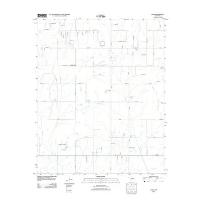
2013 Map of Eason
USGS Topo · Published 2013About this map
McKiddyville and Eason anchor this survey of the Oklahoma prairie, showing a landscape defined by small water bodies and rural cemeteries. The drainage patterns of Bourbonais Cr and Little Buckhead Cr reveal a terrain of subtle elevation changes, where local life centered around points like Dahlgren Lake and Smith Lake. The presence of the Muldrow Army Heliport in the southwestern quadrant provides a modern military contrast to the long-standing agricultural grid.
Find a feature on this map
43 named features on this map. Tap any name to fly to it.
Don’t see what you’re looking for? This feature index may not catch every label — zoom into the map to look around manually.
Map Details
Editions of this 2013 Eason Map
This is the sole edition of this map. No revisions or reprints were ever made.
Other maps of this area

1893 · Norman
USGS Topo · 1:62,500

1898 · Purcell
USGS Topo · 1:125,000

1898 · Pauls Valley
USGS Topo · 1:125,000

1902 · Pauls Valley
USGS Topo · 1:125,000

1910 · McComb
USGS Topo · 1:62,500

1936 · Norman
USGS Topo · 1:62,500

1954 · Oklahoma City
USGS Topo · 1:250,000

1957 · Ardmore
USGS Topo · 1:250,000

1957 · Oklahoma City
USGS Topo · 1:250,000
1958 · Tribbey
USGS Topo · 1:24,000