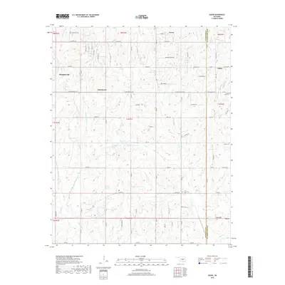
2018 Map of Eason
USGS Topo · Published 2018About this map
Slaughterville and McKiddyville anchor this section of Central Oklahoma, where rural communities are defined by a network of sectional roads and creek drainages. The landscape is marked by several small water bodies including Smith Lake, Conklin Lake, and Dahlgren Lake, which drain into systems like Pond Creek and Helsel Cr. The eastern edge of the map follows the straight-line boundary between Cleveland Co and Pottawatomie Co, passing through the outskirts of Tribbey and Eason. Genealogists will find significant value in the distribution of rural burial grounds, such as Red Oak Cem, Metcalf Cem, and Cropper Cem, which serve as quiet markers of the area's early families. The transition from small settlements like Etowah to larger named roads such as Slaughterville Rd reflects the gradual development of this agricultural region into a series of interconnected rural residential clusters.
Find a feature on this map
51 named features on this map. Tap any name to fly to it.
Don’t see what you’re looking for? This feature index may not catch every label — zoom into the map to look around manually.
Map Details
Editions of this 2018 Eason Map
This is the sole edition of this map. No revisions or reprints were ever made.
Other maps of this area

1893 · Norman
USGS Topo · 1:62,500

1898 · Purcell
USGS Topo · 1:125,000

1898 · Pauls Valley
USGS Topo · 1:125,000

1902 · Pauls Valley
USGS Topo · 1:125,000

1910 · McComb
USGS Topo · 1:62,500

1936 · Norman
USGS Topo · 1:62,500

1954 · Oklahoma City
USGS Topo · 1:250,000

1957 · Ardmore
USGS Topo · 1:250,000

1957 · Oklahoma City
USGS Topo · 1:250,000
1958 · Tribbey
USGS Topo · 1:24,000