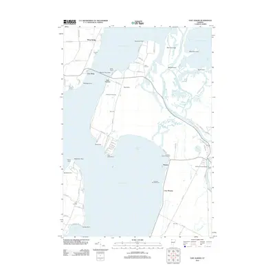
2012 Map of East Alburg
USGS Topo · Published 2012About this map
Lake Champlain dominates this landscape where the waters of the Missisquoi River wind through complex marshes and islands toward the Maquam Bay. The geography is defined by a series of points and ridges, such as Black Duck Ridge and McGregor Point, which have shaped the settlement patterns of East Alburg and West Swanton. The Missisquoi Bay Bridge serves as a vital corridor across the water, connecting these lakefront communities. Historically significant structures and family markers are found throughout the area, notably the Swanton Covered Bridge and several burial grounds including Riverside Cem, Reynolds Cem, and Janes Cem. The shoreline is also a destination for recreation, evidenced by Lakewood Campground and Camp Maquam. This map details the intricate network of creeks, like Charcoal Cr and Dead Cr, that lace the wetlands surrounding Hog Island, illustrating the unique aquatic environment of the Vermont lakefront.
Find a feature on this map
91 named features on this map. Tap any name to fly to it.
Don’t see what you’re looking for? This feature index may not catch every label — zoom into the map to look around manually.
Map Details
Editions of this 2012 East Alburg Map
This is the sole edition of this map. No revisions or reprints were ever made.
Other maps of this area

1895 · Rouse Point
USGS Topo · 1:62,500

1907 · Rouse Point
USGS Topo · 1:62,500

1914 · St. Albans
USGS Topo · 1:48,000

1916 · St. Albans
USGS Topo · 1:62,500

1939 · Rouses Point
USGS Topo · 1:62,500

1943 · Rouses Point
USGS Topo · 1:62,500

1943 · St. Albans
USGS Topo · 1:62,500

1950 · Lake Champlain
USGS Topo · 1:250,000

1956 · Rouses Point
USGS Topo · 1:62,500

1958 · Lake Champlain
USGS Topo · 1:250,000