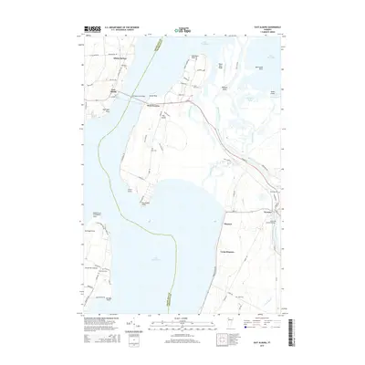
2015 Map of East Alburg
USGS Topo · Published 2015About this map
Lake Champlain defines this section of the Vermont-Quebec borderlands, where the Missisquoi River empties into the northern reaches of the lake. The landscape is a network of marshes and islands, including Hog Island and Mudgett Island, separated by channels like Charcoal Creek and Dead Creek. Human settlement is clustered around historic transport points, with Swanton and its notable Swanton Covered Bridge anchoring the southeastern corner. Further north and west, smaller communities such as Alburg Springs and East Alburg sit along the corridors leading toward the Canadian border. Genealogists will find several family-named burial grounds throughout the area, including Reynolds Cem, Tabor Cem, and Janes Cem, while the lakefront is dotted with recreation spots like Camp Maquam and Holiday Point.
Find a feature on this map
76 named features on this map. Tap any name to fly to it.
Don’t see what you’re looking for? This feature index may not catch every label — zoom into the map to look around manually.
Map Details
Editions of this 2015 East Alburg Map
This is the sole edition of this map. No revisions or reprints were ever made.
Other maps of this area

1895 · Rouse Point
USGS Topo · 1:62,500

1907 · Rouse Point
USGS Topo · 1:62,500

1914 · St. Albans
USGS Topo · 1:48,000

1916 · St. Albans
USGS Topo · 1:62,500

1939 · Rouses Point
USGS Topo · 1:62,500

1943 · Rouses Point
USGS Topo · 1:62,500

1943 · St. Albans
USGS Topo · 1:62,500

1950 · Lake Champlain
USGS Topo · 1:250,000

1956 · Rouses Point
USGS Topo · 1:62,500

1958 · Lake Champlain
USGS Topo · 1:250,000