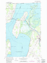
1964 Map of East Alburg
USGS Topo · Published 1987About this map
The northern waters of Lake Champlain define this borderland landscape, where the Missisquoi River feeds into the expansive Missisquoi Bay. In the mid-1960s, the area reflects a complex geography of islands and peninsulas, dominated by the Missisquoi National Wildlife Refuge and its network of wetlands such as Big Marsh Slough and Dead Creek. The proximity to the international border is marked by a U.S. Customs post near Alburg Springs, while the Central Vermont railroad tracks cross the water via the Missisquoi Bay Bridge to connect East Alburg and West Swanton. Genealogists will find several burial grounds mapped, including Riverside Cem and Tabor Cem on Hog Island. The landscape transitions from the managed wilds of the Maquam Bay Wildlife Management Area to the developing shorelines at Maquam and Camp Maquam.
Find a feature on this map
72 named features on this map. Tap any name to fly to it.
Don’t see what you’re looking for? This feature index may not catch every label — zoom into the map to look around manually.
Map Details
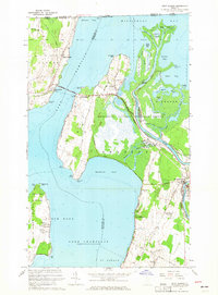
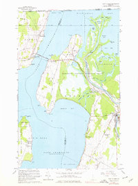
Editions of this 1964 East Alburg Map
3 editions found
Other maps of this area

1895 · Rouse Point
USGS Topo · 1:62,500

1907 · Rouse Point
USGS Topo · 1:62,500

1914 · St. Albans
USGS Topo · 1:48,000

1916 · St. Albans
USGS Topo · 1:62,500

1939 · Rouses Point
USGS Topo · 1:62,500

1943 · Rouses Point
USGS Topo · 1:62,500

1943 · St. Albans
USGS Topo · 1:62,500

1950 · Lake Champlain
USGS Topo · 1:250,000

1956 · Rouses Point
USGS Topo · 1:62,500

1958 · Lake Champlain
USGS Topo · 1:250,000