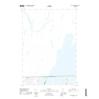
2018 Map of East Alburg OE N
USGS Topo · Published 2018About this map
Lake Champlain dominates the southern landscape of this international border survey, where the waters of Chapman Bay meet the shoreline at Province Point. This 2018 study details the transition from the aquatic environment of Shad Island and Metcalfe Island to the agricultural and residential lands of northern Vermont. The boundary between the United States and Canada is a prominent feature, separating Franklin County from Quebec. Inland, a dense network of watercourses like Ruisseau Black and the Rivière du Sud drains the low-lying terrain. Local infrastructure is represented by Greenwoods Airfield and historical markers such as Greenwood Cem along Greenwoods Rd, reflecting the rural character and family-held lands of this borderland region.
Find a feature on this map
27 named features on this map. Tap any name to fly to it.
Don’t see what you’re looking for? This feature index may not catch every label — zoom into the map to look around manually.
Map Details
Editions of this 2018 East Alburg OE N Map
This is the sole edition of this map. No revisions or reprints were ever made.
Other maps of this area

1895 · Rouse Point
USGS Topo · 1:62,500

1907 · Rouse Point
USGS Topo · 1:62,500

1914 · St. Albans
USGS Topo · 1:48,000

1916 · St. Albans
USGS Topo · 1:62,500

1939 · Rouses Point
USGS Topo · 1:62,500

1943 · Rouses Point
USGS Topo · 1:62,500

1943 · St. Albans
USGS Topo · 1:62,500

1950 · Lake Champlain
USGS Topo · 1:250,000

1956 · Rouses Point
USGS Topo · 1:62,500

1958 · Lake Champlain
USGS Topo · 1:250,000