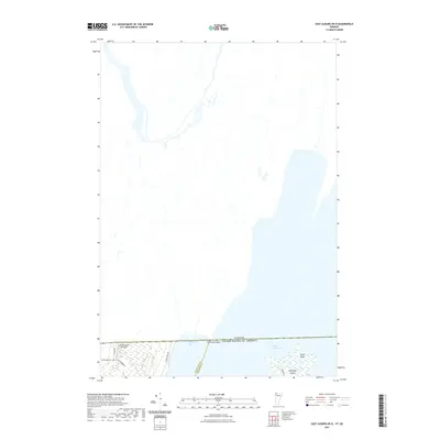
2021 Map of East Alburg OE N
USGS Topo · Published 2021About this map
The international border between Canada and the United States defines the northern reaches of this landscape, where the waters of Lake Champlain dominate the southeastern corner. This borderland region is characterized by low-lying wetlands and islands, including Shad Island and Metcalfe Island, which sit just off the shoreline. Much of the mapped area consists of the Canadian territory immediately north of the boundary line, providing a rare look at how rural road networks and property lines terminate or transition at the 45th parallel.
Find a feature on this map
13 named features on this map. Tap any name to fly to it.
Don’t see what you’re looking for? This feature index may not catch every label — zoom into the map to look around manually.
Map Details
Editions of this 2021 East Alburg OE N Map
This is the sole edition of this map. No revisions or reprints were ever made.
Other maps of this area

1895 · Rouse Point
USGS Topo · 1:62,500

1907 · Rouse Point
USGS Topo · 1:62,500

1914 · St. Albans
USGS Topo · 1:48,000

1916 · St. Albans
USGS Topo · 1:62,500

1939 · Rouses Point
USGS Topo · 1:62,500

1943 · Rouses Point
USGS Topo · 1:62,500

1943 · St. Albans
USGS Topo · 1:62,500

1950 · Lake Champlain
USGS Topo · 1:250,000

1956 · Rouses Point
USGS Topo · 1:62,500

1958 · Lake Champlain
USGS Topo · 1:250,000