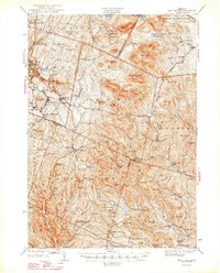
1948 Map of East Barre
USGS Topo · Published 1948About this map
The granite-rich hills of Central Vermont define the landscape in this 1940s-era survey, highlighting the industrial legacy of Barre and the surrounding quarry towns. The villages of Websterville, Lower Websterville, Graniteville, and Upper Graniteville are clustered near Millstone Hill, where the Springhouse Quarry and numerous unlabelled pits indicate the scale of the local stone industry. This industrial activity is contrasted by the protected woodlands of Jones State Forest and Groton State Forest, which preserve the higher elevations of the Knox Mountains.
Find a feature on this map
114 named features on this map. Tap any name to fly to it.
Don’t see what you’re looking for? This feature index may not catch every label — zoom into the map to look around manually.
Map Details
Editions of this 1948 East Barre Map
2 editions found

Other maps of this area

1896 · Strafford
USGS Topo · 1:62,500

1919 · Royalton
USGS Topo · 1:62,500

1919 · Montpelier
USGS Topo · 1:62,500

1921 · Montpelier
USGS Topo · 1:62,500

1922 · Barre
USGS Topo · 1:48,000

1924 · Barre
USGS Topo · 1:62,500

1924 · Randolph
USGS Topo · 1:48,000

1926 · Randolph
USGS Topo · 1:62,500

1931 · Mt. Cube
USGS Topo · 1:62,500

1931 · Woodsville
USGS Topo · 1:48,000