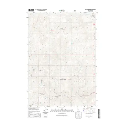
2013 Map of East Basin Creek
USGS Topo · Published 2013About this map
The Salmon River carves a deep path through the southern portion of the Challis National Forest in this 2013 survey of Custer County. This landscape is defined by the confluence of major tributaries and the recreational access provided by the modern corridor of State Hwy 75. Significant landmarks include the dramatic curve at Mormon Bend, where several public sites like Mormon Bend Campground and Riverside Campground are situated along the riverbanks. High-elevation water features such as E Basin Lake and the drainage of W Fork Yankee Fork illustrate the complex watershed of the region. The map also details a network of forest access routes including Basin Creek Rd and E Basin Creek Rd, which connect the remote drainages of Basin Cr and Deadwood Cr to the primary valley thoroughfares.
Find a feature on this map
33 named features on this map. Tap any name to fly to it.
Don’t see what you’re looking for? This feature index may not catch every label — zoom into the map to look around manually.
Map Details
Editions of this 2013 East Basin Creek Map
This is the sole edition of this map. No revisions or reprints were ever made.
Other maps of this area

1919 · Custer
USGS Topo · 1:125,000

1922 · Custer
USGS Topo · 1:125,000

1957 · Challis
USGS Topo · 1:250,000

1960 · Challis
USGS Topo · 1:250,000

1963 · Challis
USGS Topo · 1:250,000

1963 · Custer
USGS Topo · 1:24,000

1963 · Stanley
USGS Topo · 1:24,000

1963 · Basin Butte
USGS Topo · 1:24,000

1963 · Casino Lakes
USGS Topo · 1:24,000
1964 · Knapp Lakes
USGS Topo · 1:24,000