
1963 Map of Custer
USGS Topo · Published 1964About this map
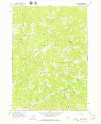
Custer sits at the confluence of several mountain drainages within the Challis National Forest, serving as a focal point for mining activity in the central Idaho mountains during the early 1960s. The landscape is defined by the steep descent of the Yankee Fork river, which is flanked by numerous mineral extraction sites including the Sunbeam Mine and various unnamed Mine and Prospects locations. Evidence of industrial operations is visible through mapped Tailings and a network of Jeep Trails that penetrate the high-elevation terrain.
Find a feature on this map
30 named features on this map. Tap any name to fly to it.
Don’t see what you’re looking for? This feature index may not catch every label — zoom into the map to look around manually.
Map Details
Editions of this 1963 Custer Map
2 editions found
Other maps of this area

1919 · Custer
USGS Topo · 1:125,000

1922 · Custer
USGS Topo · 1:125,000

1930 · Casto
USGS Topo · 1:125,000

1957 · Challis
USGS Topo · 1:250,000

1960 · Challis
USGS Topo · 1:250,000

1963 · Challis
USGS Topo · 1:250,000

1963 · Challis Creek Lakes
USGS Topo · 1:24,000

1963 · Casto
USGS Topo · 1:24,000
1963 · Elevenmile Creek
USGS Topo · 1:24,000
1963 · Sherman Peak
USGS Topo · 1:24,000