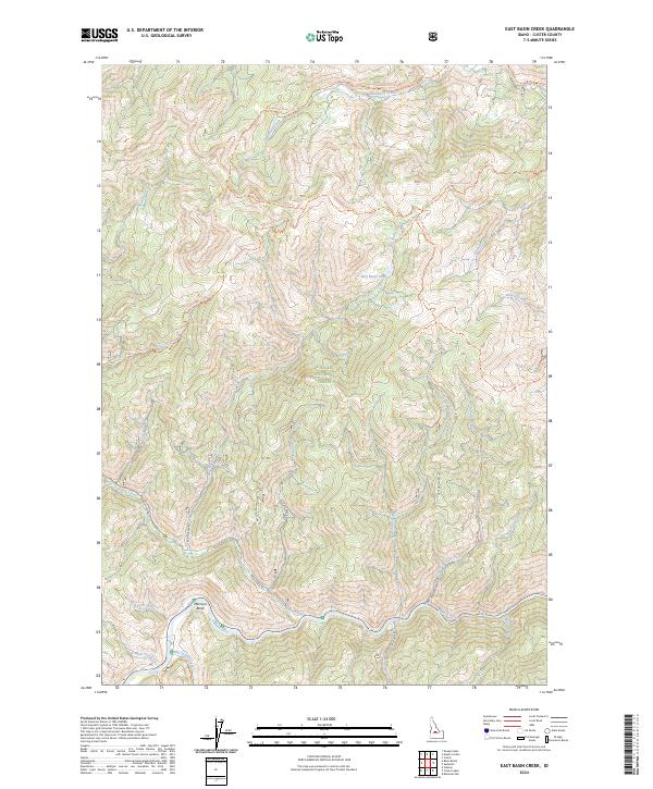
2024 Map of East Basin Creek
USGS Topo · Published 2024About this map
The Salmon River carves a path through this high-country landscape in Custer County, Idaho, where protected wilderness and national forest lands converge. The southern reaches of the map are defined by the White Clouds Wilderness, a region of intense topography where the river loops around Mormon Bend near the Big Casino area. This terrain is marked by a complex network of drainage systems, including Upper Harden Creek and Lower Harden Creek, which flow southward to meet the main river channel.
Find a feature on this map
28 named features on this map. Tap any name to fly to it.
Don’t see what you’re looking for? This feature index may not catch every label — zoom into the map to look around manually.
Map Details
Editions of this 2024 East Basin Creek Map
This is the sole edition of this map. No revisions or reprints were ever made.
Other maps of this area

1919 · Custer
USGS Topo · 1:125,000

1922 · Custer
USGS Topo · 1:125,000

1957 · Challis
USGS Topo · 1:250,000

1960 · Challis
USGS Topo · 1:250,000

1963 · Challis
USGS Topo · 1:250,000

1963 · Custer
USGS Topo · 1:24,000

1963 · Stanley
USGS Topo · 1:24,000

1963 · Basin Butte
USGS Topo · 1:24,000

1963 · Casino Lakes
USGS Topo · 1:24,000
1964 · Knapp Lakes
USGS Topo · 1:24,000