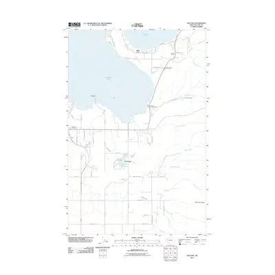
2011 Map of East Bay
USGS Topo · Published 2011About this map
Finley Point and the southern shoreline of Flathead Lake define this 2011 survey, showing a landscape shaped by water and agriculture. The southeastern corner of the lake, known as East Bay, is bordered by orchards and residential developments, including the Eagle Nest RV Resort. Moving inland, the map captures a sophisticated irrigation network featuring the Polson Z Canal, Polson D Canal, and the Bousquet Ditch, which support the farms and ranches surrounding Dupuis and Turtle Lake.
Find a feature on this map
66 named features on this map. Tap any name to fly to it.
Don’t see what you’re looking for? This feature index may not catch every label — zoom into the map to look around manually.
Map Details
Editions of this 2011 East Bay Map
This is the sole edition of this map. No revisions or reprints were ever made.
Other maps of this area

1920 · Flathead Lake
USGS Topo · 1:125,000

1955 · Choteau
USGS Topo · 1:250,000

1956 · Wallace
USGS Topo · 1:250,000

1957 · Choteau
USGS Topo · 1:250,000

1958 · Choteau
USGS Topo · 1:250,000

1960 · Wallace
USGS Topo · 1:250,000

1962 · Choteau
USGS Topo · 1:250,000

1964 · Bull Island
USGS Topo · 1:24,000

1964 · Wild Horse Island
USGS Topo · 1:24,000

1964 · East Bay
USGS Topo · 1:24,000