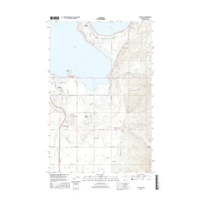
2017 Map of East Bay
USGS Topo · Published 2017About this map
Polson and the southern reaches of Flathead Lake anchor this 2017 survey, where the landscape transitions from the developed lakeshore to the steep elevations of Minesinger Ridge. The map details the intricate water management systems of the Mission Valley, including the Polson D Canal, Polson Z Canal, and the Bousquet Ditch, which redirect water across the valley floor. To the east, the terrain rises sharply toward the Hellroaring Reservoir and the drainage of Hell Roaring Creek. Small communities like Finley Point and Turtle Lake are shown with their contemporary road networks, such as S Shore Road and Finley Point Road, reflecting the area's mix of residential growth and agricultural heritage. Distinctive landmarks like Bird Point and Blumhagen Spring provide specific points of interest for those studying the local topography of Lake County.
Find a feature on this map
85 named features on this map. Tap any name to fly to it.
Don’t see what you’re looking for? This feature index may not catch every label — zoom into the map to look around manually.
Map Details
Editions of this 2017 East Bay Map
This is the sole edition of this map. No revisions or reprints were ever made.
Other maps of this area

1920 · Flathead Lake
USGS Topo · 1:125,000

1955 · Choteau
USGS Topo · 1:250,000

1956 · Wallace
USGS Topo · 1:250,000

1957 · Choteau
USGS Topo · 1:250,000

1958 · Choteau
USGS Topo · 1:250,000

1960 · Wallace
USGS Topo · 1:250,000

1962 · Choteau
USGS Topo · 1:250,000

1964 · Bull Island
USGS Topo · 1:24,000

1964 · Wild Horse Island
USGS Topo · 1:24,000

1964 · East Bay
USGS Topo · 1:24,000