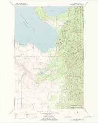
1988 Map of East Bay
USGS Topo · Published 1988About this map
Finley Point extends into the southeastern waters of Flathead Lake, framing a landscape of managed waterways and protected mountain slopes within the Flathead Indian Reservation. The eastern edge is dominated by the steep ascent of the Mission Mountains Tribal Wilderness, where numerous drainages like Hell Roaring Creek and Centipede Creek flow toward the shore. A complex network of irrigation infrastructure, including the Pablo Feeder Canal and Polson Feeder Canal, moves water across the flatter western plains near Turtle Lake. Local social and economic life in the late 1980s is anchored by features like the Drive-in Theater and various Gravel Pits, while the topography of Minesinger Ridge and Skidoo Bay illustrates the transition from high alpine wilderness to developed lakeside terrain.
Find a feature on this map
44 named features on this map. Tap any name to fly to it.
Don’t see what you’re looking for? This feature index may not catch every label — zoom into the map to look around manually.
Map Details
Editions of this 1988 East Bay Map
This is the sole edition of this map. No revisions or reprints were ever made.
Other maps of this area

1920 · Flathead Lake
USGS Topo · 1:125,000

1955 · Choteau
USGS Topo · 1:250,000

1956 · Wallace
USGS Topo · 1:250,000

1957 · Choteau
USGS Topo · 1:250,000

1958 · Choteau
USGS Topo · 1:250,000

1960 · Wallace
USGS Topo · 1:250,000

1962 · Choteau
USGS Topo · 1:250,000

1964 · Bull Island
USGS Topo · 1:24,000

1964 · Wild Horse Island
USGS Topo · 1:24,000

1964 · East Bay
USGS Topo · 1:24,000