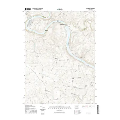
2016 Map of East Brady
USGS Topo · Published 2016About this map
The Allegheny River carves a deep, sinuous path through this landscape, creating a series of dramatic loops that define the local geography. Along these bends, riverfront communities like East Brady, Phillipston, and Wattersonsville serve as traditional focal points for regional settlement. The map reveals a land heavily shaped by both the river and its many tributaries, including Redbank Creek and Huling Run, which have eroded the plateau into a complex network of ridges and hollows such as Burnt Ridge and Peach Hill.
Find a feature on this map
127 named features on this map. Tap any name to fly to it.
Don’t see what you’re looking for? This feature index may not catch every label — zoom into the map to look around manually.
Map Details
Editions of this 2016 East Brady Map
This is the sole edition of this map. No revisions or reprints were ever made.
Other maps of this area

1900 · Kittanning
USGS Topo · 1:62,500

1901 · Rural Valley
USGS Topo · 1:62,500

1902 · Kittanning
USGS Topo · 1:62,500

1903 · Rural Valley
USGS Topo · 1:62,500

1906 · Clarion
USGS Topo · 1:62,500

1907 · Clarion
USGS Topo · 1:62,500

1907 · Foxburg
USGS Topo · 1:62,500

1908 · Foxburg
USGS Topo · 1:62,500

1953 · Pittsburgh
USGS Topo · 1:250,000

1954 · Pittsburgh
USGS Topo · 1:250,000