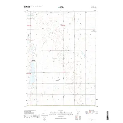
2019 Map of East Chain
USGS Topo · Published 2019About this map
The settlement of East Chain sits on the eastern shore of its namesake East Chain Lake, anchoring a landscape in Martin County defined by the intersection of glacial hydrology and human engineering. This 2019 survey captures the modern agrarian character of southern Minnesota, where natural features like Little Badger Cr and Badger Cr weave through a systematic grid of section-line roads such as 270th Ave and 50th St. Local history and family lineages are preserved at the Pleasant Prairie Cem and the Calkins Farm Cem, reflecting the generations who have managed this terrain. An intriguing physical detail is the Burnt Out Lakebed near the center of the sheet, illustrating the transition of wet prairie into productive farmland via man-made drainage systems like County Ditch Number Sixtynine. The presence of the Cornfield Canyon Airport further emphasizes the integration of modern infrastructure within this rural expanse.
Find a feature on this map
38 named features on this map. Tap any name to fly to it.
Don’t see what you’re looking for? This feature index may not catch every label — zoom into the map to look around manually.
Map Details
Editions of this 2019 East Chain Map
This is the sole edition of this map. No revisions or reprints were ever made.
Other maps of this area

1954 · Fairmont
USGS Topo · 1:250,000

1958 · Fairmont
USGS Topo · 1:250,000

1967 · Pilot Grove
USGS Topo · 1:24,000

1967 · East Chain
USGS Topo · 1:24,000

1967 · Wilmert Lake
USGS Topo · 1:24,000

1967 · Granada
USGS Topo · 1:24,000

1967 · Huntley
USGS Topo · 1:24,000

1967 · Fairmont
USGS Topo · 1:24,000

1972 · Ledyard
USGS Topo · 1:24,000

1980 · Armstrong
USGS Topo · 1:24,000